

The 16th & 23rd Corps March to Decatur

July 19, 1864. Dodge´s 16th A.C., having camped on the North Fork, Peachtree Creek, moved south on old Shallow Ford road to this point where it joined Schofield´s 23d, which had march south...
- lat34
Federal Left Wing to Decatur

July 19, 1864. The 15th & 17th, two of three corps, McPherson´s Army of the Tenn., forming the left wing of Sherman´s forces advancing on Atlanta, came this way on the last day of their march from...
- lat34
The March to Decatur
![McPherson´s Army of the Tenn. [US], Consisting of the 15th, 16th, & 17th corp, having crossed the river at Roswell, made a wide swing S.E. to cut the Georgia R.R. at & E. of Decatur. Logan´s 15th,...](http://lh3.googleusercontent.com/pMEfTewrdJrdHhC1-6gEUu5D4qP9JtdphqUAOPXeMpmIMLy_SB4fslZsgLO7ORcod9V2x51x4MPDktONIEX6t-UIIOSy)
McPherson´s Army of the Tenn. [US], Consisting of the 15th, 16th, & 17th corp, having crossed the river at Roswell, made a wide swing S.E. to cut the Georgia R.R. at & E. of Decatur. Logan´s...
- lat34
Logan's 15th & Blair's 17th A.C. to Decatur

July 19, 1864. Logan´s troops, in "light fighting order" left camp at Henderson´s Mill (.8 mile N.E.) at 5 A.M. & marched to Decatur. They were joined at this point by Blair´s corps which...
- lat34
McPherson's Divergent Line of March

July 17, 1864. At this road-fork (near old Providence Church), the 16th A.C. of the Army of the Tenn enroute from Roswell to Decatur moved by the west fork toward Nancy´s Creek where it...
- lat34
Dodge's & Blair's Columns Separate
![July 19, 1864. Blair´s 17th A.C. followed by Dodge´s 16th [US], having camped near Blake´s Mill .6 mi. N. on Old Shallow Ford Rd. the night before, moved S. to this point where their lines of...](http://lh3.googleusercontent.com/mGjGIdZ6NjLhRhpyHdlYNhldTAzbTDV7_B4u2cnKcl91U6Fug-aPzkmgMBrHSzwJXdS89qqpgllEvlJfEpz0ZKphh38)
July 19, 1864. Blair´s 17th A.C. followed by Dodge´s 16th [US], having camped near Blake´s Mill .6 mi. N. on Old Shallow Ford Rd. the night before, moved S. to this point where their lines of...
- lat34
Site: Henderson's Mill
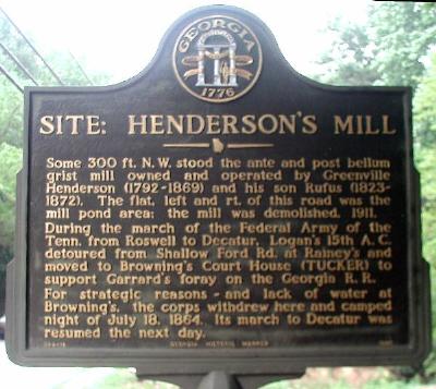
Some 300 ft N.W. stood the ante and post bellum grist mill owned and operated by Greenville Henderson (1792-1869) and his son Rufus (1823-1872). The flat, left and rt. of this road was the mill...
- lat34
Logan's Corps Moves To Henderson's Mill

July 18, 1864. Logan´s troops having detoured from Shallow Ford Rd. to Browning´s Court House (TUCKER), to co-operate with Garrard´s cav, in the destruction of the Georgia R.R. at Stone...
- lat34
Garrard's Cavalry at Stone Mtn. Depot
![July 18, 1864. Garrard´s cavalry division and Lightburn´s 15 A.C. [US] brigade moved from Browning´s Court House (Tucker), to this vicinity and destroyed 2 miles of GA R.R. track, several...](http://lh3.googleusercontent.com/Xb_lHo3NOiY-gNwMit1rcWaHavRBDheqn2_uu2t9azQFKH0CJbW0MvykaXkk-RVU08aBGSaa7MnzjDe2ZWDpZXXec-X_ZA)
July 18, 1864. Garrard´s cavalry division and Lightburn´s 15 A.C. [US] brigade moved from Browning´s Court House (Tucker), to this vicinity and destroyed 2 miles of GA R.R. track,...
- lat34
Garrard & Lightburn to Stone Mountain

The principle object of the wide swing of Federal forces S.E. from Roswell, where they crossed the Chattahoochee, was to cut the Ga. R.R. at & near Stone Mountain, thereby isolating Atlanta from...
- lat34
Browning's Court House

At or near this crossroads stood the J.P. office of Browning´s Militia District No. 572; cited in reports of Federal military operations July, 1864, as Browning´s Court House. July 18. Logan´s...
- lat34
Solomon Goodwin's Res.

The house on adjacent knoll built 1831, by Solomon Goodwin (circa 1780-1850), oldest extant house in DeKalb County, was a landmark of Federal military operation in these environs during the summer...
- lat34
Site: Blake's Mill

North Fork Peachtree Creek. West of the road was the ante-bellum structure of a mill owned and operated by John Blake (1798-1854). July 18, 1864. Blair´s 17th A.C. of McPherson´s Army of...
- lat34
The Samuel House Plantation

The large brick residence built in 1857 by Samuel House (1798-1873) was a prominent landmark during military operations by Federal forces on the Atlanta front in July, 1864. Cox´s division...
- lat34
Steatite Boulder

This steatite boulder was found on the site of a prehistoric quarry along Soapstone Ridge 8 miles south of Decatur. It shows the methods of Indians in making stone bowls, with the first girdling...
- lat34
Cyrene (Side 2)

Approximately 1.6 miles north of this location is the village of Cyrene. Founded about 1890 by C. S. Hodges and W. G. Powell, Cyrene was typical of the many mill towns established along the...
- lat34
Climax, Georgia

Climax is the highest point on the railroad between Savannah, Ga., and the Chattahoochee River. The town was laid out and named in 1883 after a branch rail line was built to Chattahoochee, Fla....
- lat34
Charles James Munnerlyn 1822-1898 (Side 1)

As a delegate to the Georgia Convention at Milledgeville, he voted for secession. After the start of the Civil War, he volunteered as a private. When his health failed he returned home and was...
- lat34
Camp Recovery

The medical camp was established on September 15, 1820 by the Southeastern Army of the United States headquartered at Fort Scott. It was used as a recuperation area for soldiers who had...
- lat34
Camp Recovery

On the east side of Flint River, twenty-one miles southwest is the site of Camp Recovery, established during the First Seminole Indian War as a hospital base to which the sick soldiers from Fort...
- lat34