Cheyenne-Deadwood Trail
Note the sign's last line about the killing of the last buffalo in the area. One sort of wonders exactly when that happens. I can't believe it was in the era when the rest stop was built, the 1960s, but I can't find any further information.
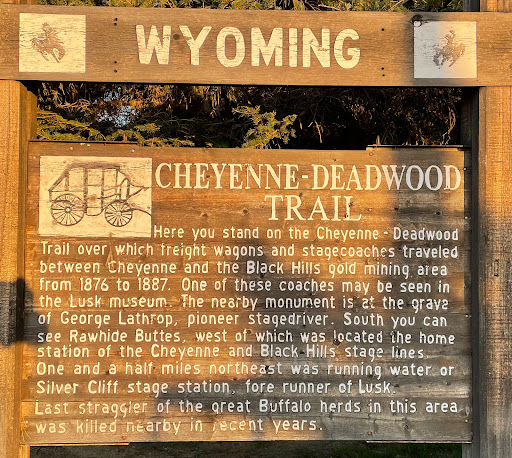
The sign text:
Here you stand on the Cheyenne-Deadwood Trail over which freight wagons and stagecoaches traveled between Cheyenne and the Black Hills gold mining area from 1876 to 1877. One of these stages may be seen in the Lusk museum. The nearby monument is at the grave of George Lathrop, pioneer stage driver. South you can see Rawhide Buttes, west of which was located the home station of the Cheyenne and Black Hills Stage Lines. One and a half miles northeast was running water or Silver Cliff stage station, fore runner of Lusk.
Last straggler of the great Buffalo herds in this area was killed nearby in recent years.
Submitted by @danbrekke