Slave Square
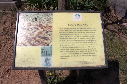
In 1852 the Atlanta City Council ruled that African-Americans were to be buried in a segregated section at the rear of Oakland Cemetery, at the eastern boundary of the original 6 acres. By the beginning of the Civil War, more than 800 persons had been buried in this section that was known as Slave Square. As more acres were purchased, the cemetery expanded around Slave Square to its current size of 48 acres. In 1866 the Atlanta City Council established a segregated burial ground at the rear of the 48 acres for African-Americans. By the 1870s most of the burial plots in Oakland had been sold, and more were needed. In 1877 the City Council ordered that the bodies and bones of the African Americans buried in Slave Square were to be removed and reburied in Oakland’s “colored pauper grounds”. The old grave spaces in Slave Square were re-plotted and resold to whites. Legal segregation at Oakland Cemetery ended in 1963 when the City of Atlanta band segregated public facilities.
Plaque courtesy Lat34North.com.
Original page, with additional info, here.
Photo credit: Byron Hooks of Lat34North.com.