Collierville The Original Village
In this area and to the east, lies the original town site of Collierville. The lands that were destined to become Collierville traveled through many periods of history before the village was established. These lands were the lands of the Chickasaw Nation hunting grounds that ran to the Kentucky state line and at various times were under the auspices of the French, English and Spanish.
When Tennessee became a state on January 11, 1796, and was admitted to the Union an June 1, 1796, it would bring about many changes for the Western Territory. What became Collierville was involved in two treaties with the Chickasaw Nation. In the treaty in October, 1818, the Chickasaws ceded lands between the Tennessee, Mississippi and Ohio Rivers to the thirty-fifth degree, north latitude. This created a third grand division that would be known as West Tennessee. This treaty moved the Chickasaw Nation south of the thirty-fifth degree, north latitude. The second treaty in October, 1832, removed the Chickasaw to their new lands in Oklahoma.
Collierville lands north of the State Line Road (now Poplar Ave.) were divided into three types of grants: Revolutionary Grant, Occupant Grant and a grant whereby a person could claim land not for sale, but could have first choice when it became available. The lands south of State Line Road were lands of the Chickasaw Nation and were not open for sale until after the 1832 treaty. The grant played a major role in Collierville's development was the Wm. A. Tharp grant for 640 acres north of State Line Road and She-Kah's grant of 640 acres that lay south of State Line Road.
There was a boundary dispute between Tennessee and Mississippi that was not settled until after a fourth survey had been run in 1837. The boundary line was moved approximately four plus miles south where it is located today. Until the settlement of the boundary dispute, settlers didn't know where to pay their taxes or where to vote. Collierville was in Civil District Ten (see attached plat of Shelby County Twelfth Civil Districts, 1836) and would see an additional 14.5 square miles or 9.298 acres added to their district.
Before the boundary dispute was settled, there appeared in the Memphis Enquirer an ad for "The Town of Collier for Sale." In this ad from J.R. Collier and H.G. Barbee, lots were offered for sale in October 1836. The ad states "It is a high and salubrious situation and well watered." Jesse Collier had purchased 150 acres of the Tharp grant located north of State Line Road. Wm. A. Tharp was a land speculator whose home was in Henry County, Tennessee. The Post Office at this time was located in Fayette County, Tennessee, and was called the State Line Post Office. In 1837, it was moved to Shelby County, and the name was changed to Collierville Post Office.
When the village of Collierville was carved from the wilderness, it was nestled between the two waterways of the Wolf River and Nonconnah Creek on a ridge that protected it from flood waters. The area had fertile soil, average rain fall, and a desirable growing season. Collierville was located in the corner of Fayette County, Tennessee, and north Mississippi making this the location of a trade center for this region.
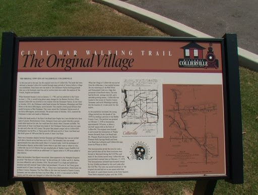
As the population increased, the young village entered into the decade of the 1850's by sending a petition to Shelby County Court. The petition was granted on February 7, 1850 to incorporate approximately 320 acres, or about a one-half square mile as the Town of Collierville. The original town located at and around the intersection of Poplar Avenue (formerly State Line Road) and Mt. Pleasant Road (formerly the Mount Pleasant Holly Springs Road) and State Line Road (see LaFayette and Colliersville map drawn by Wilson in 1863).
This incorporation served the town for only a short period since all but three structures were burned or destroyed during the Civil War, and many of the citizens moved away. Collierville was incorporated a second time on February 17, 1870. This incorporation included land formerly owned by Amy Kimble purchased by Irby and Leake after the Civil War. The town was moved southwest of the original site and laid out as one square mile from the center of a park (know known as the Town Square). These limits remained in place until the 1950's.
Submitted from the Shelby County Register's Office.