

The King's Head (2) - West Country Ales plaque, 19 Cheltenham Road, Bishop's Cleeve, Glos

This ceramic plaque is affixed to the front wall of the pub near the main entrance. It is in very nice condition. These plaques were first used by the Gloucestershire brewers, West...
- village
- rural settlement
- public house...
- business
- retail
- services
- geograph
Plaque at Aylesham

Snowdown was the deepest of the four main pits in the Kent Coalfield, reaching a depth of 3,083 feet - see Link . Work commenced in 1908, and coal was first brought to the surface on November...
- village
- rural settlement
- geograph
Plaque on former bandstand in Kidston Park

See NS2782 : Kidston Park for a view of the former bandstand in context. For more on the Kidstons of Ferniegair, and on the William Kidston who is mentioned in this inscription, see Link...
- park and pub...
- closeup
- geograph
Plaque on the Chambers Institution, Peebles

On the wall of this handsome public building on the High Street - NT2540 : Entrance to the Chambers Institution, Peebles. © Copyright Jim Barton and licensed for reuse under this Creative Commons...
- city
- town centre
- public build...
- geograph
Standon Puddingstone plaque

© Copyright Eirian Evans and licensed for reuse under this Creative Commons Licence . Submitted via Geograph
- village
- rural settlement
- geograph
- historic sit...
- menhir
The Caerlaverock Cairn plaque at Glencaple

For a full view of the Millennium cairn, see NX9968 : The Caerlaverock Cairn at Glencaple. © Copyright Walter Baxter and licensed for reuse under this Creative Commons Licence . Submitted via Geograph
- village
- rural settlement
- geograph
- millennium cairn
Plaque, Port Sunlight

Indicating the house in which Lord Leverhulme lived briefly. © Copyright Eirian Evans and licensed for reuse under this Creative Commons Licence . Submitted via Geograph
- house
- geograph
- historic sit...
- suburb
- urban fringe
- port sunlight
Plaque inside the former Argyll Motor Works

The plaque is located at the top of the marble staircase (see NS3880 : Inside the Argyll Car Factory), and records the official opening of the building as Loch Lomond Factory Outlets. For...
- indoor
- royal visit
- geograph
- closeup
- historic sit...
A pavement plaque near Princes Dock, Hull
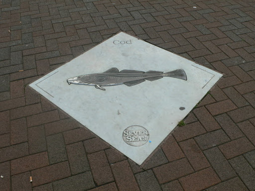
'The Seven Seas Fish Pavement' was commissioned for the Hull 1992 Festival by Kingston-upon-Hull City Council. The sculpture trail was renovated and re-launched in 2000 with assistance form...
- educational sites
- city
- town centre
- geograph
Railway footbridge plaque, Caerleon

The plaque records the official opening of this Link footbridge and the adjacent path in June 2011. © Copyright Jaggery and licensed for reuse under this Creative Commons Licence . Submitted via Geograph
- paths
- geograph
Plaque on the valve tower, Craig Goch reservoir

The plaque gives technical data of the dam's and the reservoir's construction. In modern units these are: total capacity: 7.6 million cubic metres top water area: 880,000 square metres top water...
- water resources
- valve tower
- geograph
A plaque in a Millennium garden, Denholm

The plaque forms the centrepiece of a circular paving in a small Millennium garden on the northwest side of the parish church at Kirkside. The inscription on the plaque reads:- BELOW THIS PLAQUE...
- village
- rural settlement
- millennium garden
- geograph
A plaque on a cairn in Denholm

This plaque at Kirkside commemorates tree planting in the village on 17th November 1984 by various local groups. The plaque is on this cairn NT5618 : A commemorative cairn in Denholm ©...
- village
- rural settlement
- geograph
Oban: plaque on Pulpit Hill bench

The metal bench in the centre of the viewpoint was put here in 1887 according to this plaque. See NM8529 : Oban: Pulpit Hill viewpoint benches for the bench itself. © Copyright Chris Downer...
- geograph
- viewpoint
- suburb
- urban fringe
- bench
Dunwich Heath Plaque

(Close up) © Copyright Adrian Cable and licensed for reuse under this Creative Commons Licence . Submitted via Geograph
- spanish armada
- geograph
- minsmere cliffs
- people
- events
- dunwich heath plaque
- dunwich
- july 1588
- beacon
- closeup
- heath
- scrub
- dunwich heath
Dunwich Heath Plaque
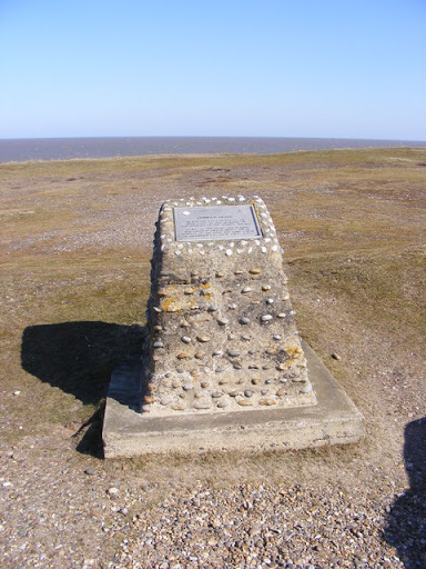
In July 1588 a beacon stood here and was lit to warn of the approach of the Spanish Armada © Copyright Adrian Cable and licensed for reuse under this Creative Commons Licence . Submitted via Geograph
- geograph
- minsmere cliffs
- people
- events
- north sea
- beacon
- dunwich
- july 1588
- dunwich heath plaque
- sea
- heath
- scrub
- dunwich heath
Treforest Primary School plaque, Pontypridd
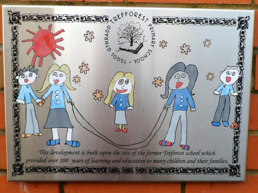
The plaque is on a wall here. Link © Copyright Jaggery and licensed for reuse under this Creative Commons Licence . Submitted via Geograph
- educational sites
- housing
- dwellings
- geograph
Plaque, Cashel National Primary School

Pictured here H5780 : Cashel National Primary School © Copyright Kenneth Allen and licensed for reuse under this Creative Commons Licence . Submitted via Geograph
- educational sites
- geograph
Commemorative Plaque in Thorpe Hesley

This plaque can be seen on a green next to Thorpe Street. © Copyright Jonathan Clitheroe and licensed for reuse under this Creative Commons Licence . Submitted via Geograph
- historic sit...
- geograph
Local Places Plaque at Savill Garden

Located beyond the entrance to the Savill Garden, this plaque was donated by the Friends of The Savill Garden in June 2006. It gives the distances from the plaque to the following local...
- park and pub...
- geograph