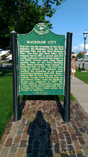
MACKINAW CITY
MACKINAW CITY
This site was the terminus of the Dixie Highway, the Mackinaw Trail, the East Michigan Pike and the West Michigan Pike. The East and West Pikes were mapped out in 1913 as gravel and dirt roads. Concrete construction began in the 1920s. Private auto clubs began making trips on the West Michigan Pike, which extended from Chicago to Mackinaw City, in 1913. The first trip, from St. Joseph to Mackinaw City, marked the beginning of an annual event that continued until 1919. Beginning in 1916 the East Pike was used for touring. Groups from Detroit came up the eastern route. Until the Mackinac Bridge was completed in 1957, the State Highway Department managed a ferry system that transported those arriving by these routes across the Straits of Mackinac.
Submitted by: Chris Carter