Cherokee Boundary
23 30
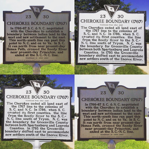
CHEROKEE BOUNDARY (1767)
In 1766-67 S.C. & N.C. negotiated
with the Cherokee to establish a
boundary between Indian land to the
west and new settlement to the east.
This north-south line ran past this
point to N.C. and on to Va. In S.C.
It ran north from near present-day
Honea Path, crossed the Reedy River
near present-day Princeton, and
ended at the S.C.-N.C. line.
CHEROKEE BOUNDARY (1767)
(Continued from other side)
The Cherokee ceded all land east of
the 1767 line to the colonies of
S.C. and N.C. In 1786, when S.C.
created its first counties, the line
from the Reedy River to the S.C.-
N.C. line south of Tryon, N.C. was
the boundary for Greenville County
between both Spartanburg and Laurens
Counties. In 1793 the Greenville
boundary shifted east to accommodate
new settlers south of the Enoree River.
Submitted by @nickyj124