The Military Road
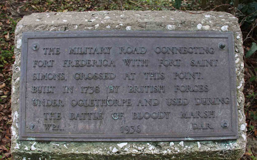
The military road connecting Fort Frederica with Fort Saint Simons crossed at this point. Built in 1736 by British forces under Oglethorpe and used during the Battle of Bloody Marsh.
Placed by the WPA and DAR in 1936.
Plaque courtesy Lat34North.com.
Original page, with additional info, here.
Photo credit: Byron Hooks of Lat34North.com.