River of the West (Sign missing)
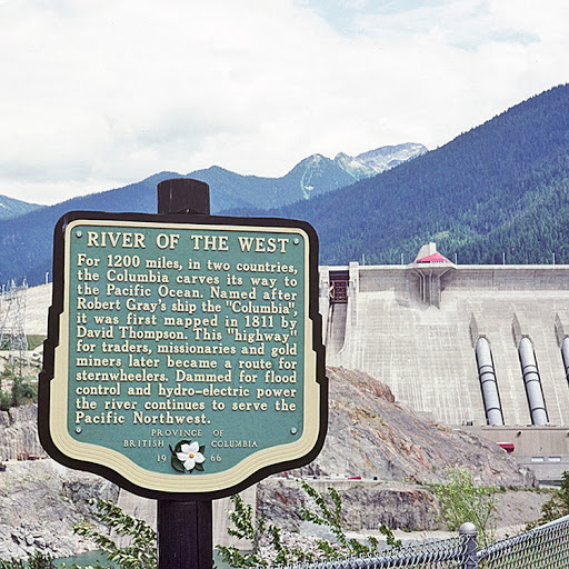
For 1200 miles, in two countries, the Columbia carves its way to the Pacific Ocean. Named after Robert Gray's ship the 'Columbia', it was first mapped in 1811 by David Thompson. This 'highway' for traders, missionaries and gold miners later became a route for sternwheelers. Dammed for flood control and hydro-electric power the river continues to serve the Pacific Northwest.
From BC's Stops of Interest
This plaque was reimagined by Joanne Hammond's project #rewriteBC (Republic of Archaeology) as:
