Rama Indian Reserve
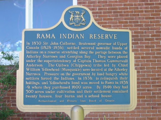
In 1830 Sir John Colborne, lieutenant-governor of Upper Canada (1828-1836), settled several nomadic bands of Indians on a reserve stretching along the portage between the Atherley Narrows and Georgian Bay. They were placed under the superintendency of Captain Thomas Gummersall Anderson. The Ojibwa (Chippewa) tribe led by Chief William Yellowhead (Musquakie) were located at the Atherley Narrows. Pressure on the government by land-hungry white settlers forced the Indians, in 1836, to relinquish their holdings, and Yellowhead's band was moved to Rama in 1838-9, where they purchased 650 ha. By 1846 they had 120 ha under cultivation and their settlement contained twenty houses, four barns and a school house.
Plaque via Alan L. Brown's site Ontario Plaques. Full page here.