Demere Road
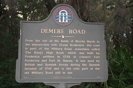
From the site of the Battle of Bloody Marsh to the intersection with Ocean Boulevard, this road is part of the Military Road, sometimes called The King´s High Road, which was built by Frederica settlers in 1738 to connect Fort Frederica and fort St. Simons. It was used by British and Spanish forces during the Spanish invasion of 1742 and is the only part of the old Military Road still in use.
GHM 063-3 GEORGIA HISTORIC MARKER 1989
Plaque courtesy Lat34North.com.
Original page, with additional info, here.
Photo credit: Byron Hooks of Lat34North.com.