
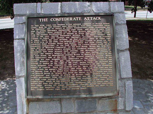
The Battle of Ezra Church - Plaque 4 - The Confederate Attack
On July 27th, Lieut. Gen. Stephen D. Lee assumed command of Hood´s former corps. Both he and Stewart directed to hold their respective corps "in readiness" and to report at Hood´s headquarters. After explaining his plan to attack Sherman´s threatening right flank, and drive it back from the railroad, Hood ordered Lee to move Brown´s and Claytron´s divisions from the eastern fortifications of Atlanta to White Hall (West End), southwest of the city, leaving Stevenson´s divisions in the lines. Stewart was ordered to follow with Loring´s and Walthall´s division, leaving French´s in place. Early the next morning, all four divisions were at White Hall. At 10:00 a.m. on the 28th, Lee ordered Brown and Clayton to move out the Lickskillet Road (Gordon Street and Road), which led from White Hall to Lickskillet (Adamsville), to the Poor House (on Gordon Street south of the main gate of Westview Cemetery). At the Poor House, Brown met Brig. Gen. Wm. H. Jackson whose cavalry division had contested Howard´s advance. His skirmishers had pressed back steadily, yet Jackson´s information indicated "the enemy´s infantry to be small". Lee also having arrived at the Poor House, he immediately ordered Brown to deploy his division on the left (southwest) side of the road, in the present cemetery Grounds. Brown deployed his four brigades with Johnston´s on the right, Sharp´s in the center, Brantly´s on the left and Manigault´s in reserve. Clayton was ordered to deploy on the right of the road, facing north. He deployed his three brigades with Gibson´s on the left, Holtzclaw´s on the right and Baker´s in reserve. Hood had ordered Lee to "move out the Lickskillet Road, attack the enemy´s right flank, and drive him from the road and the one leading from it by Mount Ezra Church (old Chapel Road)." Accordingly, Lee ordered Brown to "attack and drive the enemy to Ezra Church and hold the position" and Clayton to attack on Brown´s right. Brown´s men drove Smith´s skirmishers from Lickskillet Road and up the steep slopes to the first ridge beyond it (Anderson Park and southeastward). Finding that Logan´s right, which he was expected to turn, would overlap his own, Brown shifted his lines 250 yards to the left. Realigned, his men swept over the first ridge, driving off enemy skirmishers, charged across the intervening ground, and assaulted the Union barricades; but despite the shift to the left, Logan´s refused right was still beyond reach.
Georgia Historic Commission - Georgia Civil War Centennial Commission
Georgia Historic Commission - Georgia Civil War Centennial Commission
Plaque courtesy Lat34North.com.
Original page, with additional info, here.
Photo credit: Byron Hooks of Lat34North.com.
Nearby Plaques
Loading…